
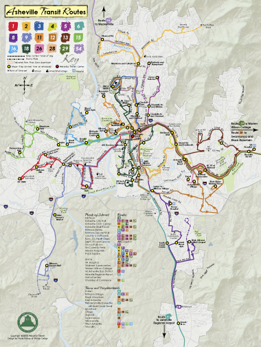
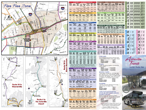
City of Asheville Transit System Route MapBefore this map brochure that I created for the City of Asheville, the transit system was using a black and white booklet of plain GIS-generated maps and text describing the individual routes, but there was nothing to show where the routes intersected, and took a genius to figure out how to navigate from one end of the city to the other. Asheville Transit wanted me to color-code the routes, so that it would be understandable at a glance where they met up, correlate to the schedules, as well as be more asthetically pleasing. James Garner, my contact on the project, provided me with GIS generated map files, which I took into Illustrator and traced to get the routes and the underlying streets. We decided on the topographical hillshading to make this transit map distinct from any other city's transit map, because Asheville is so special. Click on the images below to get a full scale, screen resolution pdf. |
|
 |
 |
